The Fossil Fuel Atlas is currently undergoing development; not all features may be available at this time. Thank you for your patience and support!
Online, interactive mapping tools to document the global energy transition from fossil fuels to cleaner alternatives and its impacts on people, nature and climate
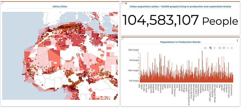
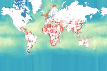
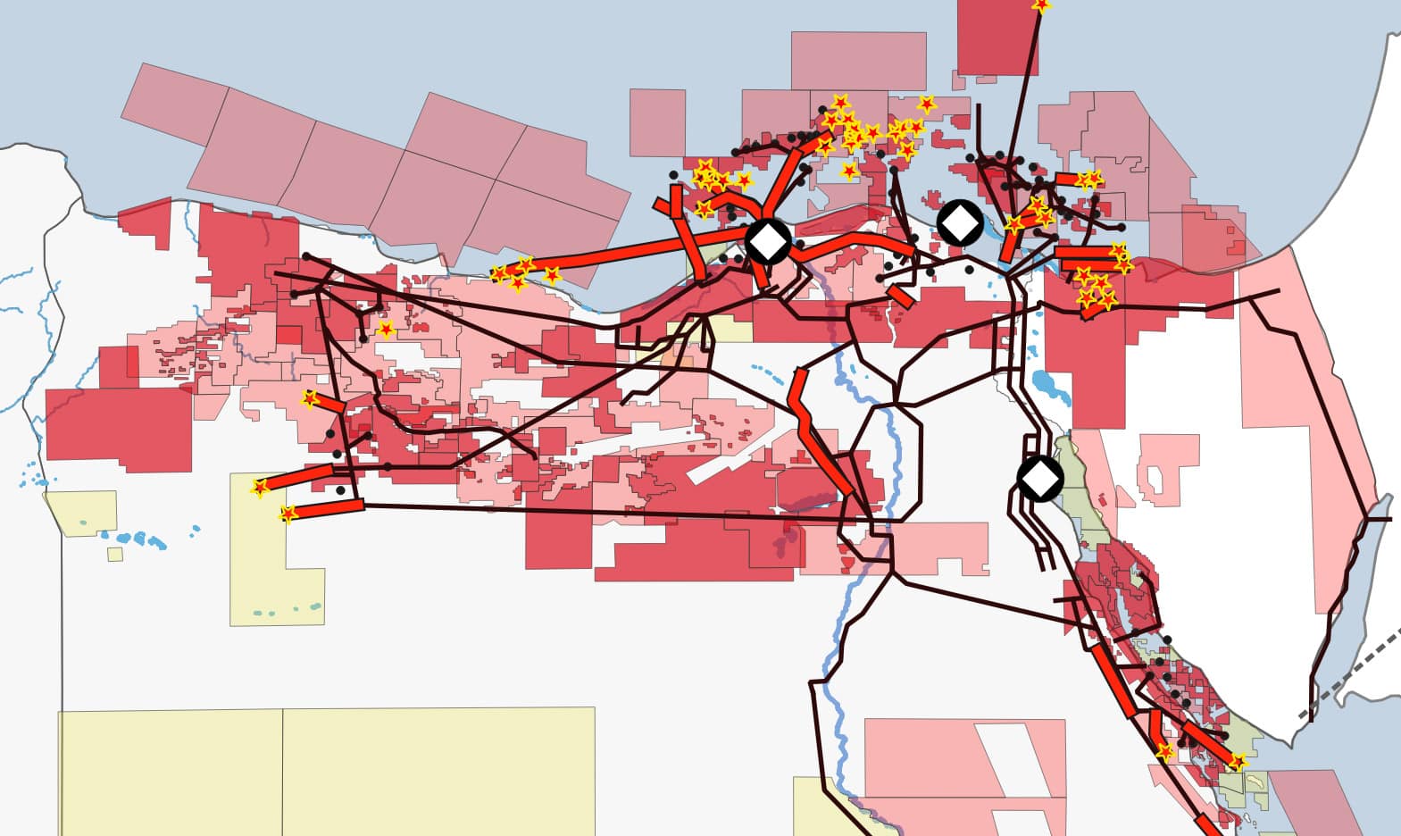
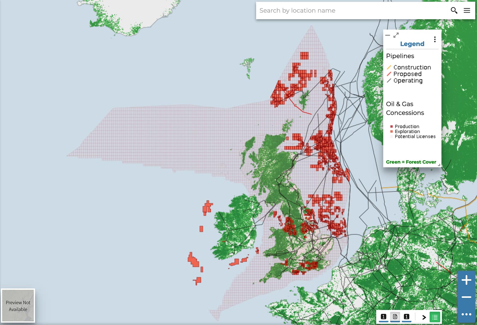
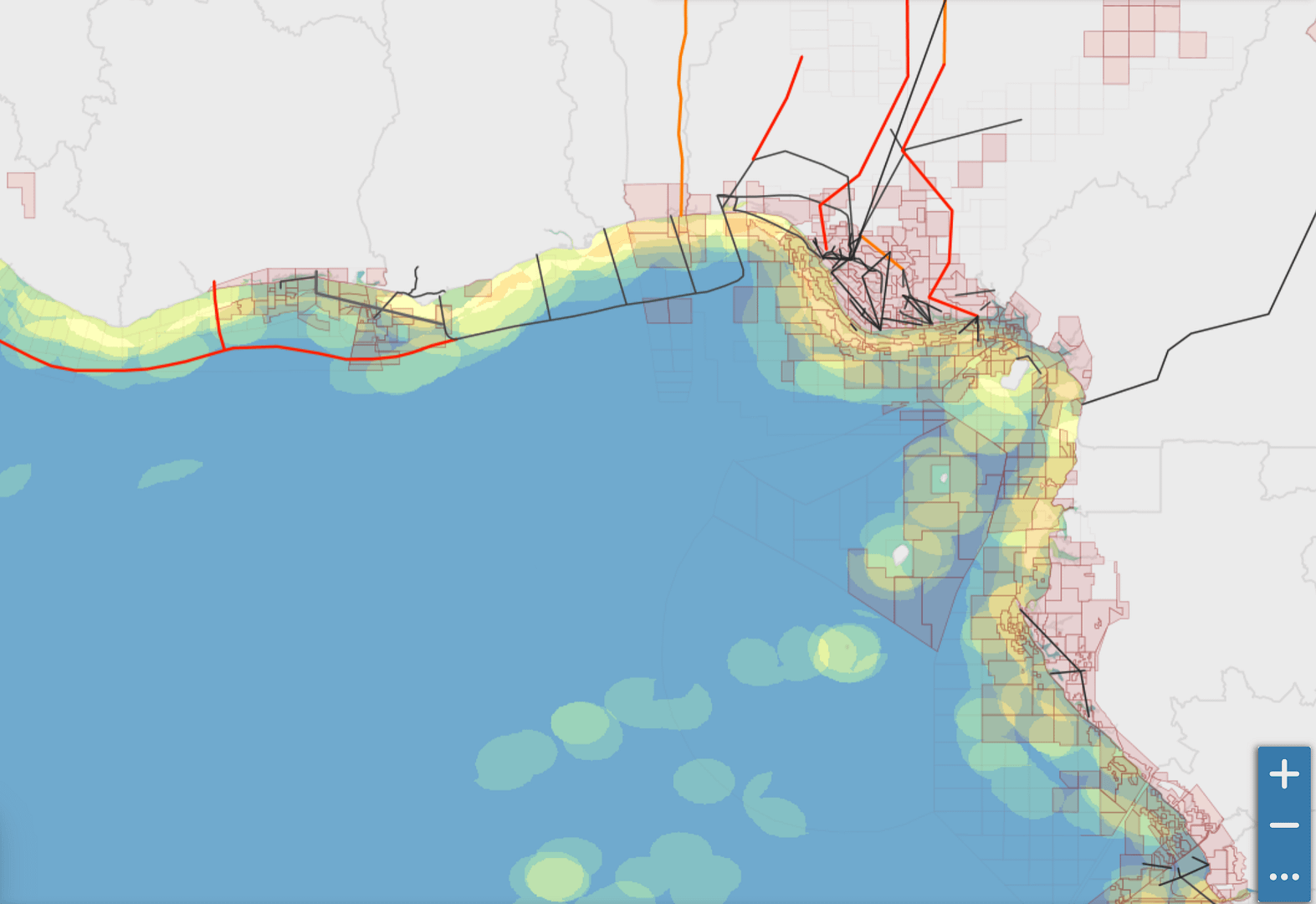
Through an open-access global mapping portal, anyone with an internet connection can visualize current and planned energy infrastructure, and how it overlaps with biodiverse areas, Indigenous territories, protected wetlands, and other areas of social, cultural and ecological importance.
Users can access a large volume of freely available data, from a variety of credible sources, on one widely accessible open-source platform.
The portal currently hosts dozens of datasets, with more being added all the time. Users can upload data to the platform to share with others, or download for their own use.
Communicate compelling stories by linking maps, analysis and photographs into dynamic ”geo-stories”.
All the maps, visualisations, geo-stories and other content produced on the Fossil Fuel Atlas can be displayed here, or easily downloaded for use in your own websites, blog-posts or publications.
The Fossil Fuel Atlas connects science and policymaking. It is underpinned by a rigorous methodologies that use mapping to pinpoint potential threats, opportunities and impacts, as a complement to more traditional social and environmental impact assessments.
The need for greater transparency about the fossil fuel industry and its impacts has never been greater.
The production of fossil fuels accounts for around three-fourths of climate pollution, driving the climate crisis. Extraction impacts people, communities and biodiversity around the world.
The industry plans to expand — risking twice as much pollution as consistent with keeping warming below 1.5C above pre-industrial levels.
As a contribution to the global response, the Fossil Fuel Atlas seeks to empower everyone to expose risks, take more targeted and earlier action, identify alternative renewable energy opportunities and accelerate the shift from fossil fuels to clean energy.
The Fossil Fuel Atlas is dedicated to equipping changemakers with the information they need to protect rights, conserve biodiversity, counter climate change, and accelerate the transition towards the people-centred solutions needed for a better world.
An early warning system
By increasing transparency, democratising data, and supporting citizen science the Fossil Fuel Atlas serves as an early warning system.
By accessing the latest information about planned fossil fuel and energy infrastructure, affected communities, stakeholders and policy-makers can get ahead of the problem by identifying emerging frontiers, raising credible concerns earlier in the process, and building support for sustainable solutions.
The Fossil Fuel Atlas covers
0
coalmines across 70 countries.
0
active oil and gas extraction sites.
0
kilometers of oil pipelines.
0
kilometers of gas pipelines in development.
Who uses the Fossil Fuel Atlas
Logos
The Fossil Fuel Atlas is a project of the Global Energy Monitor, Institute for Governance & Sustainable Development, and Stockholm Environment Institute, and works with people and organizations around the world based on the principles of open access, collaboration, transparency, and accountability.


